MAP FOLDING TECHNIQUES
One of the first considerations in the care of maps is its proper folding.
B-1. FOLDING METHODS
Figures B-1 and B-2 show ways of folding maps to make them small enough to be carried easily and still be available for use without having to unfold them entirely.
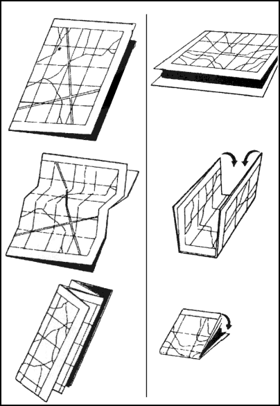
Figure B-1. Two methods of folding a map.
B-2. PROTECTION METHOD
After a map has been folded, it should be pasted in a folder for protection. Apply adhesive to the back of the segments corresponding to A, F, L, and Q (Figure B-2).
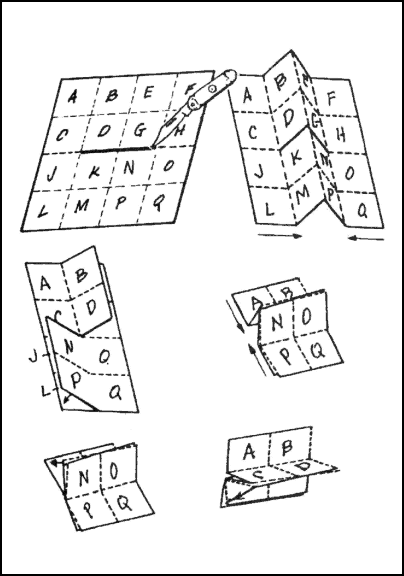
Figure B-2. How to slit and fold a map for special use.
B-3. PRACTICE CUT
It is suggested that before attempting to cut and fold a map in the manner illustrated in Figure B-2, make a practice cut and fold with a piece of paper.
|